
Every building tells a story about its condition: in its façade, its roof, its structure and even the ground beneath it. The challenge has always been capturing that story accurately, safely and in a form you can use again years from now. That is what 1DI Geospatial was built to do.
Who we are
1DI Geospatial (DBA of 1-Day Inspections, Inc) is a Clearwater, Florida company and a certified Pinellas County Small Business Enterprise. Founders Dylan and Stephanie Robbins started the company after the 2021 condominium collapse in Surfside, Florida, which exposed how much traditional inspection methods can miss. Our approach is simple: collect complete, reliable data first, then have experts turn that data into an objective picture of an asset’s condition.
Dylan brings more than ten years in the drone industry, including managing a regional UAV division at a large engineering firm, with a focus on building envelope inspections and survey-grade deliverables. Stephanie brings more than 17 years of experience in business strategy, operations and risk management across construction, insurance and technology.
What we capture
Building envelope and roof inspections
Licensed drone pilots capture high-resolution imagery of the entire exterior, roof included, without rope access, scaffolding or bucket trucks. Automated defect detection then helps locate and classify cracks, spalling and other exterior issues so nothing is left to chance.
Thermal imaging
Thermal data reveals what the eye cannot: patterns of water intrusion and delamination behind the surface. Combined with our 3-D models, it shows exactly where moisture problems are developing.
Terrestrial scanning, LiDAR and Scan-to-BIM
Using both drone-mounted and terrestrial LiDAR scanners, we produce dense point clouds of buildings and sites, inside and out. Those point clouds become Revit models, 2-D elevation drawings and accurate measurements of roofs, windows, doors and siding for architects, engineers and contractors.
Interior inspections
The same capture-first approach applies indoors, documenting interior spaces and conditions so they can be reviewed, measured and compared over time.
Digital 3-D models you can revisit
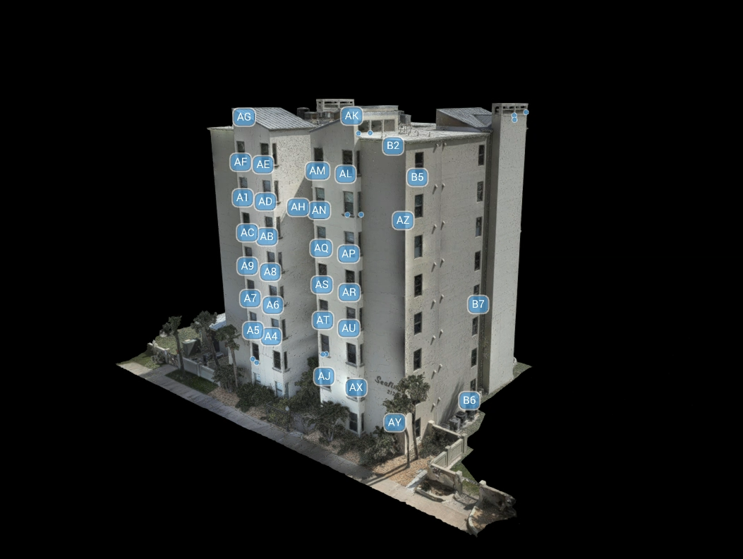
Every project can be turned into a detailed 3-D model and stored in our digital library. That gives owners a historical record of the building, making it easy to track changes between inspections, plan repairs and support future assessments.
Surveying, mapping and magnetometry
Our team has years of experience mapping large areas, highway corridors and utility corridors. Magnetometry extends that work below ground, collecting data to help locate buried features such as pipelines and abandoned wells.
Supporting Florida milestone inspections and SIRS
Florida’s building safety laws require milestone inspections and structural integrity reserve studies for many condominium and cooperative buildings. We partner with licensed Professional Engineers, who review our data and sign off on Phase One findings, and our data also supports reserve studies by documenting the condition of building components. The result is a faster, safer and more consistent inspection, with a digital record that lasts well beyond the report.
Who we work with
- Condominium associations and property managers
- Structural engineers and architects
- Developers and owners needing pre-condition surveys before construction
- Hotels and commercial property owners
- Public agencies and utilities
Let’s talk about your building
Whether you are preparing for a milestone inspection, planning a renovation or simply want a complete digital record of an asset, we would be glad to help. Contact us, call (727) 558-1678 or email dylan@1di-geospatial.com to schedule an inspection.